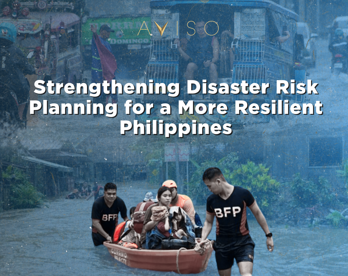
Between early August and early September 2026, consecutive tropical cyclones and an enhanced southwest monsoon flooded large parts of Luzon and the Visayas. At the peak of the event, 88 cities and municipalities were placed under a state of calamity, and the National Disaster Risk Reduction and Management Council (NDRRMC) reported roughly 8.8 million people affected across ten regions. By September 7, infrastructure damage had reached ₱7.79 billion and agricultural losses ₱4.4 billion, with 4,467 houses damaged. Transport corridors were cut, flights were grounded, and low-lying communities in Pampanga, Cavite, and Bulacan absorbed the worst of the flooding.
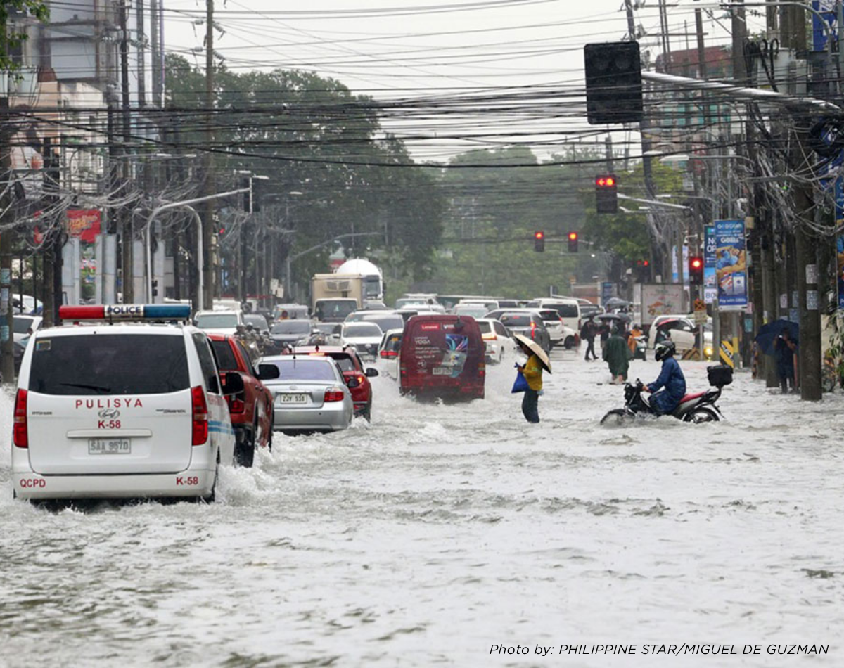
Events of this scale are not simply weather emergencies. They are recurring stress tests of how land is used, how infrastructure is sited, and how development decisions account — or fail to account — for hazard exposure. The Philippines cannot prevent the southwest monsoon or the roughly 20 tropical cyclones that cross its area of responsibility each year. What is within the country’s control is how well it plans for, and builds around, that exposure. The open question is whether existing disaster risk policy is translating into results on the ground.
From Policy to Implementation: The Philippine Gap
The Philippines has one of the most legally comprehensive risk-informed spatial planning systems in the Asia-Pacific region. Under this framework, disaster and climate risk assessments (CDRA) are required inputs into Comprehensive Land Use Plans (CLUPs) — the primary instrument local government units (LGUs) use to regulate land use — as well as zoning ordinances, Comprehensive Development Plans, Local Disaster Risk Reduction and Management Plans, and Local Climate Change Action Plans.
In two reports released on May 26, 2026, and in late August by the World Bank. It has found that this architecture is undermined in implementation: weak enforcement, uneven technical capacity among LGUs, and political interference. Smaller municipalities — often the most exposed to hazards but the least resourced — struggle to meet even baseline compliance requirements for hazard mapping and risk-informed zoning.
This is consistent with the country’s broader disaster-financing pattern. Since 2011, the World Bank has extended three successive Disaster Risk Management Development Policy Loans (2012, 2015, and a US$500 million loan in 2020) specifically to help the national government build institutional capacity for risk management. The Asian Development Bank (ADB) has separately approved back-to-back US$500 million disaster resilience programs, most recently citing the Philippines’ exposure to roughly 20 typhoons and up to 150 earthquakes of magnitude 4.0 or higher every year, with about 60% of national land area and nearly three-quarters of the population exposed to multiple hazards.
Table 1. Selected Philippine Disaster Loss Indicators
|
Indicator |
Figure |
|
Recorded annual average damage, all hazards |
~US$7.7B (₱422B), ≈1.7% of 2023 GDP |
|
Total storm-related economic impact, 1990–2020 |
≥US$20B |
|
Average annual GDP loss from typhoons |
₱133B (0.7–1.0% of GDP) |
| Typhoon Haiyan (2013) damages and losses |
US$12.9B, ≈4.7% of 2013 GDP |
| Projected cumulative climate-related economic cost |
7.6% of GDP by 2030; 13.6% by 2040 |
| 2026 habagat season (as of Sept. 7) |
₱7.79B infrastructure, ₱4.4B agriculture, 43 deaths |
The recurring pattern across these figures is that disaster losses in the Philippines are not isolated shocks; they are a structural drag on GDP that recurs, on average, every year. Measured against this, the effectiveness of disaster risk planning should be judged not by the number of plans and ordinances on file, but by whether vulnerability is actually declining.
Lessons from Neighboring Cities
The OECD’s 2018 assessment of disaster risk management policy in five Southeast Asian cities: Bandung (Indonesia), Bangkok (Thailand), Cebu (Philippines), Hai Phong (Viet Nam), and Iskandar (Malaysia), concluded that the region’s fast-growing cities remain broadly underprepared for disaster risk, even where individual policy tools are sound. Three cases outside that study illustrate different approaches worth noting.
Singapore — planning drainage as a system, not a parcel. Since 2006, Singapore’s national water agency, PUB, has run the Active, Beautiful, Clean (ABC) Waters Programme, which integrates drainage upgrades with land-use and park planning rather than treating stormwater infrastructure as a stand-alone utility. PUB pairs “source” measures (on-site detention basins, bioretention) with “pathway” measures (widened and deepened canals) under a catchment-wide strategy, and by 2017 had completed 36 such projects. Lesson: flood management works best when embedded in long-term land-use and infrastructure planning, not layered on afterward.
Jakarta — the cost of ignoring subsidence. World Bank studies place Jakarta’s average land subsidence at roughly 5 cm per year, driven substantially by groundwater extraction, with parts of North Jakarta subsiding 15–25 cm per year; on that trajectory, some areas were projected to sit 4–5 meters below sea level by 2025. An estimated 40% of the city now sits below sea level. Lesson: risk has to be assessed at the scale of the watershed and aquifer, not the individual lot — a subsidence-driven hazard is invisible in a single-parcel site inspection.
Bangkok — pricing risk before it arrives. World Bank climate projections cited in flood-cost research indicate Bangkok’s flood-related costs could rise by roughly 73% by 2050 purely as a result of climate change, independent of further urban growth. Lesson: current hazard maps are a floor, not a ceiling — forward-looking risk assessment should factor in a widening baseline, not just historical flood extents.
Taken together, these cases point to the same conclusion the World Bank reached for the Philippines: legal frameworks and mapping tools matter less than whether risk data is actually used to constrain where and how development happens.
Building With Nature: Sustainability as Resilience
Sustainability in the Philippine context is often framed narrowly around energy efficiency or green certification. In a disaster-prone archipelago, it has a more immediate meaning: reducing exposure and protecting the natural systems that absorb hazard impact before it reaches built assets.
That means protecting watersheds, wetlands, and mangroves that buffer storm surge and slow runoff; incorporating permeable surfaces and detention capacity into site design rather than maximizing impervious coverage; and designing structures and drainage to the hazard and rainfall conditions of the specific site rather than a generic standard. Singapore’s blue-green infrastructure approach and the broader literature on nature-based flood defenses both point to the same finding: engineered infrastructure (pumps, dikes, canals) and nature-based measures (wetlands, bioswales, mangrove buffers) perform better as a combined system than either does alone. Development that ignores this, filling wetlands, hardening natural drainage paths, building over floodplains does not just create risk for the site in question; it typically displaces water onto neighboring properties and public infrastructure. This is the natural bridge to how disaster risk translates into site-level decisions: understanding land-use suitability, hazard exposure, and a site’s long-term physical performance is a due diligence question, not only an environmental one.
Beyond Location: How Resilience Can Influence Land Value
Hazard exposure is one of several inputs that can influence how land and property are assessed —alongside site conditions, drainage, market conditions, and accessibility. The available evidence, both local and international, indicates that this influence can be material, though it varies widely by severity, location, and market context.
Site suitability. Flood exposure, landslide susceptibility, drainage capacity, and soil conditions can affect whether a given site supports its intended highest and best use — or whether mitigation costs need to be built into the feasibility analysis from the outset.
Marketability and demand. Documented Philippine cases show the range this can take. In Provident Village, Marikina — repeatedly and severely flooded since Typhoon Ondoy in 2009 — appraised residential values fell from roughly ₱6,000 per square meter pre-flood to about ₱2,900 per square meter post-flood as of 2012, a discount of close to 50%, based on bank and independent appraisal data points. A separate review citing University of the Philippines research found residential properties in flood-prone areas of Metro Manila experienced 10–20% declines in market value following major flood events, with recovery taking several years.
International benchmarks. The peer-reviewed hedonic-pricing literature on flood risk and property values generally finds discounts in a comparable range: 6–20% in a widely cited US study, up to 18% in Australian data, and around 11% in a recent French analysis of flood-zone properties. The direction is consistent even where the magnitude differs by market: buyers and appraisers do price in hazard exposure, particularly after a property has actually flooded rather than merely being mapped as at risk.
Development and operating costs, and valuation considerations. Resilience measures — elevated foundations, on-site detention, flood-resistant materials — along with insurance, maintenance, and potential construction delays, feed directly into project feasibility. For valuation and highest-and-best-use work specifically, hazard exposure, mitigation already in place, and the surrounding infrastructure’s flood performance are all relevant inputs alongside conventional market comparables.
It would be inaccurate to claim that every flood-prone property automatically loses value, or that every resilience investment commands a premium — the evidence above shows outcomes depend on severity, location, and how the market perceives the risk over time. What the data does support is that hazard exposure is a quantifiable, not merely qualitative, input into site suitability and valuation work — the kind of analysis feasibility studies and valuation practice are built to provide.
The Wider Economic Cost
The property-level effects above sit inside a larger pattern. ADB attributes an average 0.7–1.0% annual GDP drag to typhoons alone, separate from earthquake losses of roughly ₱43.5 billion a year. Research firm GHD’s Aquanomics study projects the Philippines could lose a cumulative US$124 billion to storms, floods, and drought between 2022 and 2050 — with floods and storms accounting for over 90% of that figure — equivalent to an average annual GDP loss of 0.7%. Agriculture is disproportionately exposed: GHD projects annual output losses in the sector rising past 5% by 2030 and 8% by 2050.
Beyond the headline figures, disruption compounds through several channels: damaged roads and bridges delay the movement of goods and labor; households and businesses lose working days and income; national and local budgets are redirected from planned development spending toward emergency response and rehabilitation; and repeated disruption can weigh on investor confidence in specific locations over time. Infrastructure resilience is, in this light, not simply a public-safety expenditure — it is a determinant of regional competitiveness and business continuity.
A More Risk-Informed Approach
| Strengthen the use of risk data | Integrate CDRA hazard maps, NDRRMC historical loss records, and forward-looking climate projections — not just current flood extents — into CLUPs and zoning decisions, following Bangkok’s experience that historical maps understate future exposure. |
| Close the implementation gap the World Bank identified | Prioritize technical and financial support for smaller, under-resourced LGUs, where the enforcement gap is widest. |
| Integrate resilience into land-use decisions at the site level | not only the barangay or city level — a lesson underscored by Jakarta’s subsidence experience. |
| Combine engineered and nature-based infrastructure | following Singapore’s catchment-wide model rather than isolated drainage fixes. |
| Incorporate hazard exposure explicitly into feasibility and valuation work | using the range of evidence in Section 5 rather than treating it as a qualitative caveat. |
| Track results, not just outputs | measuring whether plans in place are reducing recorded losses over time, not simply whether a CLUP or LDRRMP has been filed. |
Resilience as a Foundation for Growth
The Philippines cannot eliminate its exposure to typhoons, monsoon rains, or seismic activity. It can make better-informed decisions about where and how it builds. The World Bank’s “policy-rich but implementation-poor” assessment is, in one sense, encouraging: the legal and technical framework already exists. What remains is enforcement, local capacity, and the discipline to let risk data — not just planning documents — shape land-use and investment decisions. Done well, that discipline protects lives and also protects the long-term functional and economic value of land, buildings, and the infrastructure connecting them.
References:
References:
National Disaster Risk Reduction and Management Council (NDRRMC), situation reports on the 2026 southwest monsoon (habagat) and successive tropical cyclones, as reported by BusinessMirror (“NDRRMC: Death toll of storms, habagat climbs to 43,” Sept. 7, 2026) and Philstar.com (Aug. 31, 2026).
World Bank, two reports dated May 26, 2026, published Aug. 28, 2026, as reported by Manila Bulletin, “World Bank: Philippines ‘policy-rich but implementation-poor’ on disaster-risk planning,” Aug. 31, 2026.
Philstar.com, “Cyclones, habagat toll climbs to 33 dead, 8.8 million affected,” Aug. 31, 2026; Philippine Inquirer, “88 areas under state of calamity due to habagat, cyclones – NDRRMC.”
ADB, funding announcement for the Second Disaster Resilience Improvement Programme, as reported by Gulf News.
World Bank, “Philippines: New Support to Strengthen National Disaster Risk Management Capacity and Respond to COVID-19,” press release, April 9, 2020.
ADB, Second Disaster Resilience Improvement Programme funding announcement, reported by Gulf News.
ADB, Public Sector Management (Disaster Risk Management), sector assessment, adb.org/sites/default/files/linked-documents/57309-001-ssa.pdf.
ADB, Disaster Resilience in Asia, as reported by Philippine Daily Inquirer, “PH urged to face risks from calamities head on,” July 2, 2021.
World Bank, “The Philippines: Transferring the Cost of Severe Natural Disasters to Capital Markets.”
World Bank, Philippines Country Climate and Development Report (2022), as cited in IMF, Philippines: Selected Issues, IMF Staff Country Reports Vol. 2025, Issue 334.
OECD (2018), Building Resilient Cities: An Assessment of Disaster Risk Management Policies in Southeast Asia, OECD Green Growth Studies, OECD Publishing, Paris.
PUB (Singapore’s National Water Agency), “Stormwater Management” and “Flood Resilience,” pub.gov.sg; National Library Board Singapore, “Active, Beautiful, Clean Waters (ABC Waters) Programme.”
GFDRR, “Keeping Indonesia’s Capital Safer from Floods”; World Bank studies on Jakarta land subsidence rates, as compiled in peer-reviewed research (ResearchGate, “Study on the risk and impacts of land subsidence in Jakarta”).
UCL Asiatic Affairs, “Jakarta’s uncertain future: finding solutions to climate change and its unequal social consequences in Indonesia’s capital,” citing World Bank (2011) data.
World Bank climate cost projections as cited in The Conversation / PreventionWeb, “Indonesia: Jakarta’s flood costs will increase by up to 400% by 2050, research shows.”
RichestPH, “The Impact of Natural Disasters on Flood Zone Real Estate in the Philippines,” citing University of the Philippines research on Metro Manila flood-prone residential property values.
Bin, O. and Landry, C. (2013); Rajapaksa et al. (2016), as summarized in ScienceDirect, “The impact of flood dynamics on property values”; Frontiers in Environmental Economics (2026), “Flood risk management and real-estate prices: between prevention and ‘crowding out’ effect.”
GHD, Aquanomics: The Economics of Water Risk and Future Resilience (2022), as reported by BusinessWorld / Institute for Climate and Sustainable Cities.